 On Monday the 16th, Bill and I drove out to Ft. Bowie National Historic Site. http://www.nps.gov/fobo/ You drive in, park at a trailhead then walk the 1.5 miles to the Fort ruins and the visitor center. They keep it this way so that while you’re walking you can get a feel for the distance and what people then might have had to deal with, not to mention that along the 1.5 mile trail are the ruin of a Butterfield
  stagecoach stop as well as a cemetery commemorating some of the fallen. It’s really an amazing place and not too difficult a hike. There are some mild up hills and down hills, but nothing like some of the places we hiked. It was also really cold the day we went there. The high never reached 50 and it was a little windy.
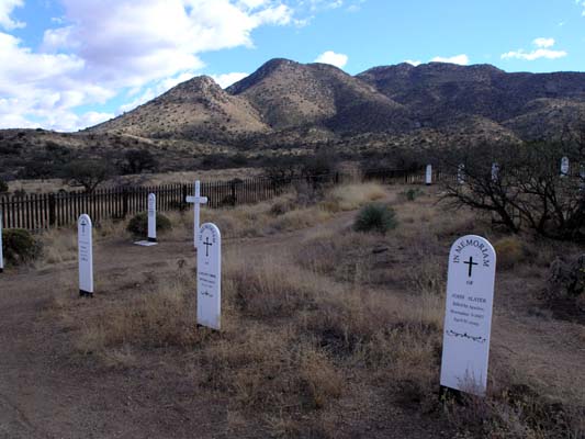
Taken from the National Historic Site Map: “Guardian of Apache Pass: For more than 20 years Fort Bowie and Apache Pass ere focal points of military operations by the U.S. Army against the Chiricahua Apaches for control of the region. This bitter struggle, which ended only with the surrender of Geronimo in 1886, helped to determine the pattern of development on America’s
 Southwestern frontier during the last half of the 19th century.”
The way they have preserved the area is really incredible. Along the foot paths through the actual fort ruin they have placed pictures that
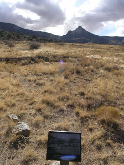
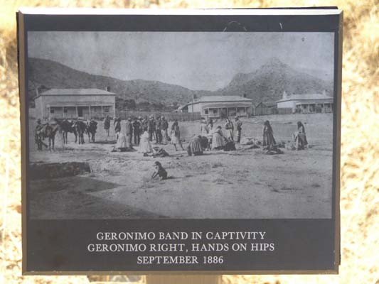 were taken back during that time, the thing that’s really neat is that these pictures look to be places in almost the exact spot that they would have originally been taken from. You can look down at the picture, then up at the landscape and see the exact same frame.
Ft Bowie really is an amazing place, but be ready for the 1.5 mile walk each way to get there and back, there is no way to drive in. There is wheelchair access somewhere, not sure where, but I believe you still have to hoof it a bit. There is just something spine-tingling about being able to walk on the same ground where so much history (for better or for worse) took place.
;-)K